Version 2.70, released July 24, 2025. For iOS 13.0 or later (*).
Designed for iPhone, also works nicely on iPad. And on Apple Silicon Macs.
Release 2.70 adds the ability to change fuel temperatures in 0.1-degree increments, previously, only 1-degree increments were possible. Thanks to the user who suggested this change.
Ad-free. No account needed. No subscriptions. Fully-functional without online access. No tracking. No analytics.
GET THE NUMBERS YOU NEED… FAST!
Much quicker than mechanical computers and classic electronic aviation calculators.
Thumbwheels/sliders are used to enter values, faster than aligning discs, or typing numbers.
Instantly see the effect of a change on all other related parameters.
Results are shown in all conventional aviation units of measure simultaneously.
WATCH THIS 30-SECOND VIDEO. AND SEE THE SPEED!
ALL THE FEATURES OF CLASSIC FLIGHT COMPUTERS
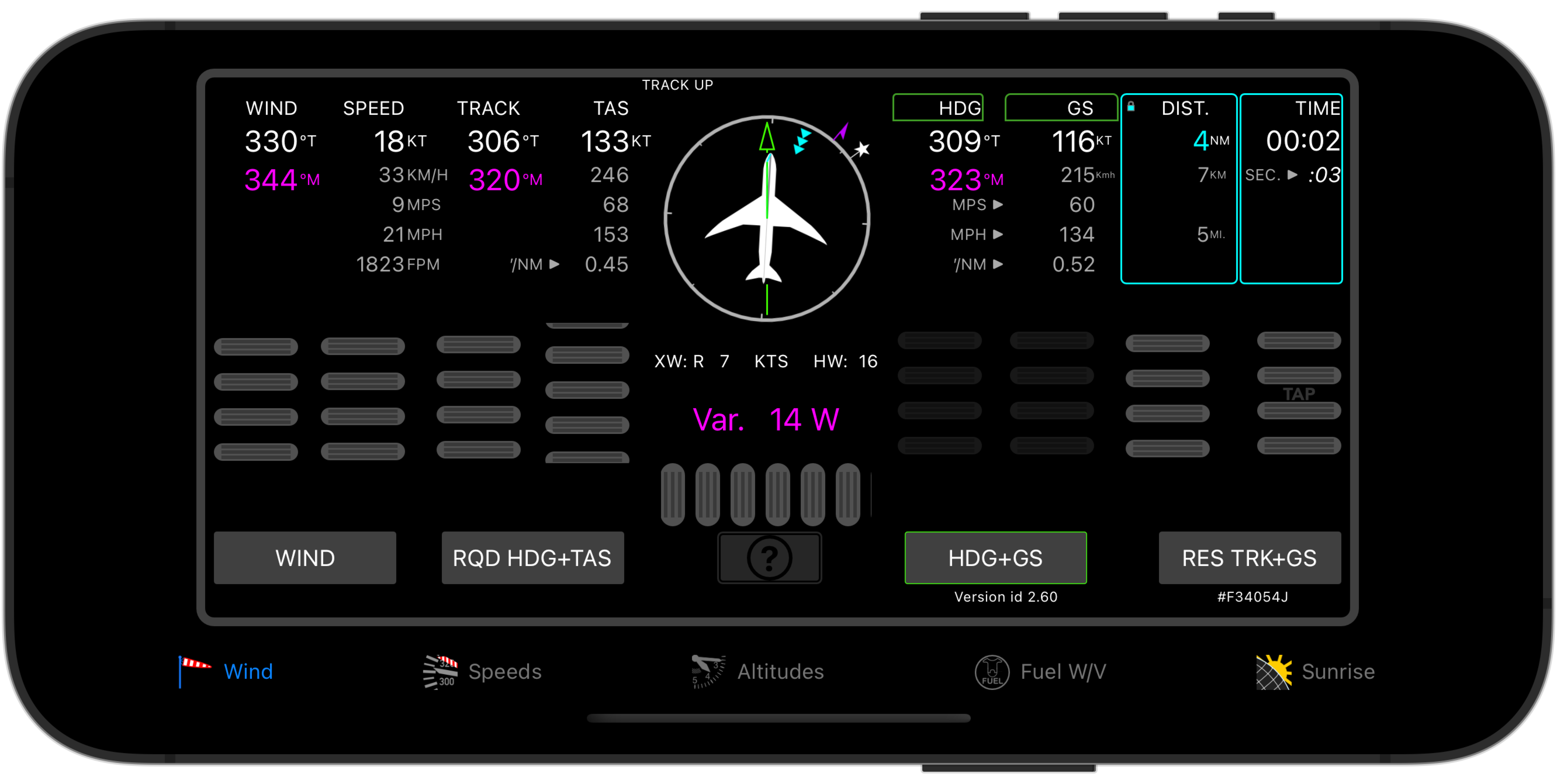
- Wind-triangle and Speed-Time-Distance solutions.
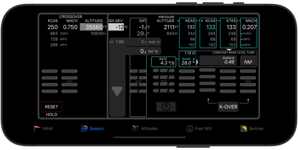
- CAS, TAS and Mach. And EAS.
- Pressure, Density and True Altitude. Fuel Weight & Volume.
- Aviation unit conversions.
PLUS THESE ADVANCED CALCULATIONS
- Works for speeds up to Mach 3.4, and altitudes up to 100 000 feet.
Handles calculations for any aircraft, up to military fast jets and supersonic transport aircraft now in development; - Convert between QNH and QFE.
Double-check height and altitude values published on approach charts where QFE is used; - Precise temperature-correction of altitudes in cold (and hot) weather.
Maintain safe terrain clearance during instrument approaches in non-standard temperatures; - Find crossover altitude.
Know at what altitude to transition from CAS to Mach and vice-versa; - Determine turn radius/diameter/circumference, and required bank angle or turn rate.
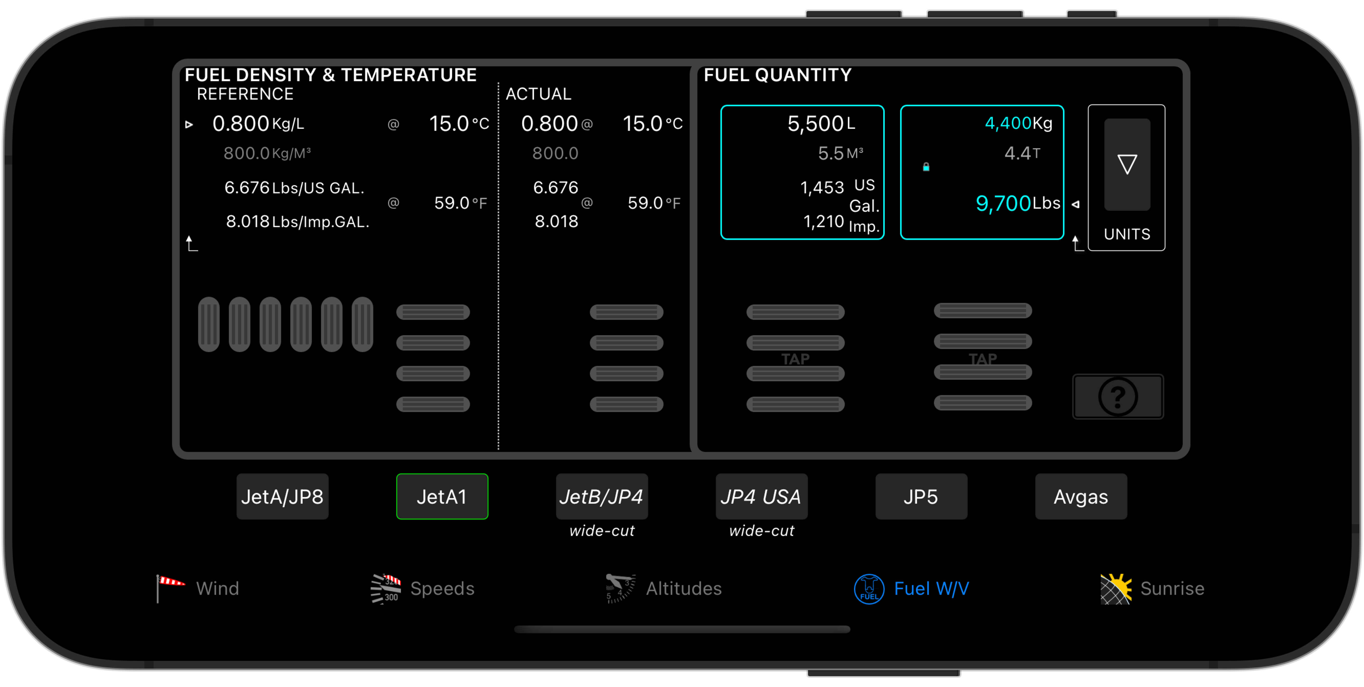
Increase awareness of the space required to manoeuver your aircraft, for example during a circling approach; - Use actual fuel density to calculate precise fuel weight and volume for aviation fuels.
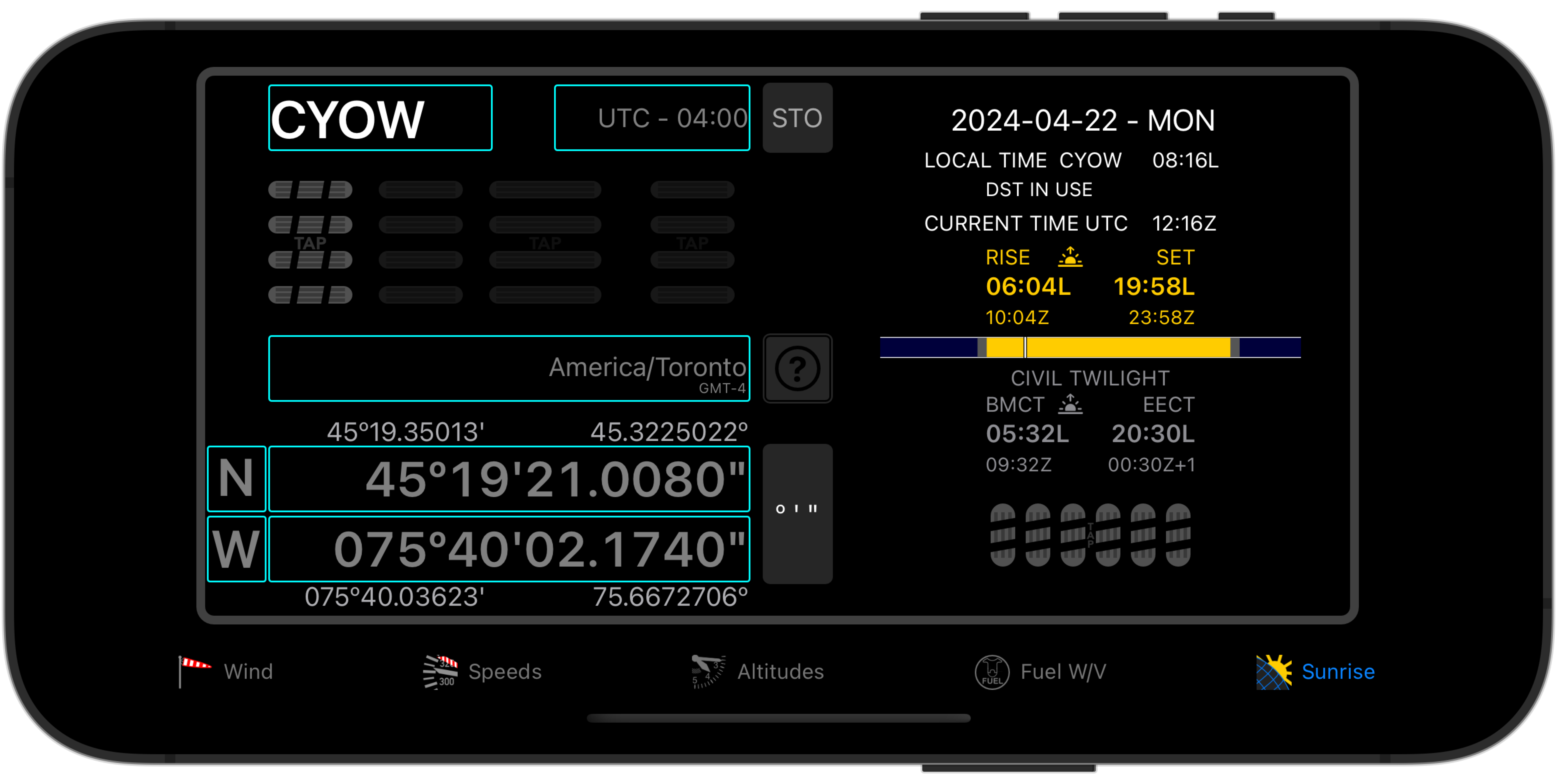
Convert between gallons, litres or cubic metres and pounds, kilograms or tons, taking into account supplier variations in fuel temperature and density. - Get sunrise, sunset and civil twilight times (present, past and future) for any location on Earth (except directly at the poles).
Know whether to log takeoff/landing times as day or night. Determine whether takeoff and landing will be at night or day on any future (or past) date.
A database of airport locations and ICAO codes is provided, and you can edit or add your own. - Uses your iOS device’s barometer to display actual altitude (*). Optionally log date/timestamped altitude data (**).
Turns your device into a (non-certified) barograph. Export logged data for use in other applications.
Requires an iOS device with built-in barometric altimeter.
(*) displays cabin altitude when flying in pressurized aircraft.
(**) if enabled, an entry is recorded everytime altitude changes by 1 foot or more. - Display static air temperature (SAT), total air temperature (TAT) and temperature rise for any airspeed and altitude.
Complement or crosscheck your aircraft’s temperature indications;
CLICK OR TAP THE IMAGES BELOW FOR DETAILS
SPEEDS & TURN DIMENSIONS TAB
WIND TRIANGLE CALCULATIONS TAB
ALTITUDE CALCULATIONS TAB
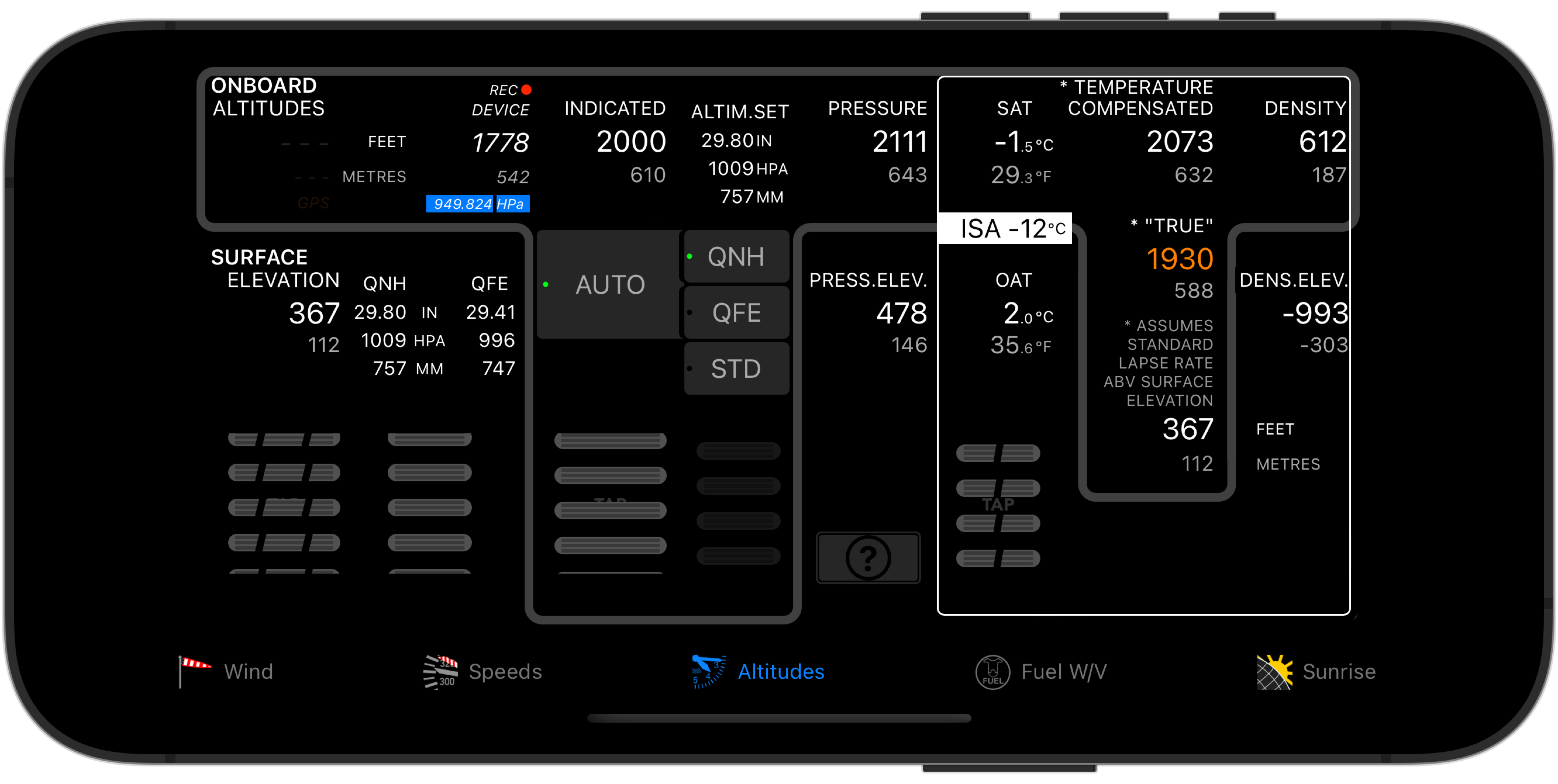
NOTE: The above illustration depicts a device with a barometric sensor, with both display and logging of device altitude enabled. Not all devices have this sensor.
FUEL WEIGHT AND VOLUME TAB
SUNRISE, SUNSET AND CIVIL TWILIGHT TIMES TAB
